
Public Review Begins for Bed Stuy North Rezoning
The southern portion of Bedford Stuyvesant was rezoned back in 2007 in an effort to preserve the historic area’s low-rise character and now the city is moving ahead with similar plans for a northern portion of the neighborhood. “The proposed rezoning would protect the existing historic neighborhood character and scale on the mid-blocks, while allowing…


The southern portion of Bedford Stuyvesant was rezoned back in 2007 in an effort to preserve the historic area’s low-rise character and now the city is moving ahead with similar plans for a northern portion of the neighborhood. “The proposed rezoning would protect the existing historic neighborhood character and scale on the mid-blocks, while allowing for modest growth with incentives for permanently-affordable housing and requirements for active, engaging retail along major corridors,” says the press release. As per the map above, the area in question is bounded by Lafayette Avenue and Quincy Street to the south, Classon and Franklin Avenues to the west, Broadway to the east, and Flushing Avenue to the north. “The proposed rezoning would protect the existing historic neighborhood character and scale on the mid-blocks, while allowing for modest growth with incentives for permanently-affordable housing and requirements for active, engaging retail along major corridors.” The first step in the public review is for Community Board 3 to review and vote on after which it goes to the Borough President’s office. We’ve reproduced the entire press release on the jump for area residents and zoning geeks who want to drill a little deeper into the details.
FOR IMMEDIATE RELEASE
May 7, 2012
CONTACT:
Rachaele Raynoff / Jovana Rizzo (City Planning) – (212) 720-3471
Bedford-Stuyvesant North Rezoning Starts Public Review
May 7, 2012 – City Planning Commissioner Amanda M. Burden today announced the beginning of public review for a 140-block rezoning in Bedford-Stuyvesant North to preserve the built character of the neighborhood and direct new residential growth to major commercial corridors. The proposed rezoning would also create new opportunities for permanently affordable housing and strengthen established commercial corridors, such as Broadway, Bedford and Myrtle Avenues. This comprehensive rezoning was undertaken at the request of the Community Board and local elected officials and follows the 2007 rezoning of Bedford-Stuyvesant South, which also sought to preserve the character of the neighborhood’s noted brownstone areas while expanding opportunities and incentives for permanently-affordable housing and growth along Fulton Street and Atlantic Avenue. The current zoning in Bedford-Stuyvesant North has been mostly unchanged since 1961 and has resulted in new development that has been out of character with the existing context and without incentives for affordable housing.
Commissioner Burden said, “Bedford-Stuyvesant is a beautiful, vibrant community experiencing new growth and investment, but we must ensure that new development is in a form that complements the neighborhood context while preserving the neighborhood’s historic brownstones, rowhouses and small apartment buildings. Responding to community concerns, and developed in close collaboration with the Community Board and local elected officials. This proposal will ensure that future development is predictable and consistent with the unique and distinguished built character of the community.”
The proposed rezoning area is well served by transit and is generally bounded by Lafayette Avenue and Quincy Street to the south; Classon and Franklin Avenues to the west; Broadway to the east; and Flushing Avenue to the north.
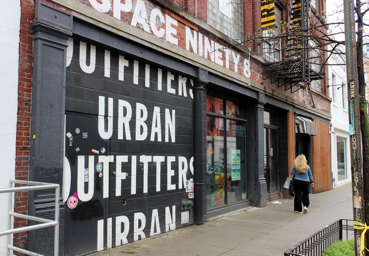
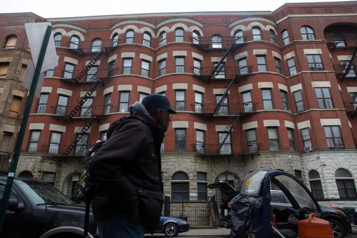
Bedford-Stuyvesant is a dynamic, growing neighborhood of historic brownstones, wooden rowhouses, churches and important institutions in Central Brooklyn. The neighborhood contains many tree-lined blocks of brownstones and rowhouses with front stoops and small gardens developed in the late 1800’s as well as large superblocks of NYCHA mid- and high-rise developments built in the 1950’s and 1960’s. The area has seen a strong rebound in the past few years with increasing private reinvestment in housing and new retail. Some of the new buildings have been out of character with the surrounding built context. Bedford-Stuyvesant’s retail corridors are also experiencing new reinvestment and growth. Residents use Myrtle Avenue and DeKalb Avenue for local services and Broadway as a regional shopping corridor.
The proposed rezoning would protect the existing historic neighborhood character and scale on the mid-blocks, while allowing for modest growth with incentives for permanently-affordable housing and requirements for active, engaging retail along major corridors.
Neighborhood Preservation and Growth Opportunities
To preserve the neighborhood’s lower-density blocks lined with small apartment buildings, brownstones and rowhouses, the current zoning would be replaced with contextual zoning districts with height limits. The majority of the rezoning area is zoned R6, which has no height limit and encourages out-of-scale buildings up to 13 stories high. A portion of the area is zoned R5, which requires large front yards with open parking. These districts would be replaced with contextual R6B districts with a height limit of five stories, and contextual R6A districts with a height limit of seven stories after a setback. The R6B districts would protect the modestly scaled rowhouse character of the east-west streets, while the R6A districts would be mapped on north-south avenues, such as Nostrand, Tompkins, Marcy, Stuyvesant, and Patchen Avenues and Marcus-Garvey and Malcolm X Boulevards, and other areas which are characterized by medium-scale residential and mixed-use buildings.
While preserving the lower-density and mid-rise blocks, new growth would be directed to appropriate areas such as Broadway, Bedford, Marcy and Myrtle Avenues. These avenues serve the surrounding residential communities with shops, offices and neighborhood grocery stores. In addition to several bus lines, the rezoning area is served by the J, M and Z subways that run above Broadway, the eastern boundary of the rezoning area, and the G line with stations at Flushing Avenue, Myrtle-Willoughby, and Bedford-Nostrand.
To allow for modest residential growth with incentives for affordable housing through the Inclusionary Housing Program, some R6 districts on Bedford Avenue, Marcy Avenue (north of Lafayette) and Myrtle Avenue (west of Bedford) would be replaced with modestly higher-density contextual R7A districts with incentives for affordable housing. The Inclusionary Housing Program incentivizes affordable housing by giving developers a 33% floor area bonus if 20% of the floor area in the building is made available for permanently-affordable housing. In the R7A district, above a maximum base height of four to six stories, buildings could reach a maximum height of eight stories after a set-back.
In addition, along Myrtle Avenue, R6 districts would be replaced with a contextual R7D district to allow for additional residential growth including affordable housing. Above a maximum base height of six to eight stories, the building could reach a maximum height of 10 stories after a set-back. The proposed R7D district would also reinforce the commercial character of this corridor by requiring active non-residential uses — such as retail, offices and community facility space — and transparency on the ground floor facing Myrtle.
New Contextual Zoning District
To respond to the unique challenges of building in close proximity to elevated trains, a new citywide contextual zoning district, C4-4L, would be established along Broadway for medium-density residential and commercial development with affordable housing. For development fronting on Broadway, it would include special height and set-back, and lot coverage regulations tailored to allow more light and air to the sidewalk by requiring buildings to setback five feet from the street line on the ground floor, and requiring an additional setback of 15 feet above a base height of three to six stories, after which buildings could rise to a maximum height of 10 stories. For lots without Broadway frontage, building height would be limited to eight stories. It also requires a continuous street line for retail continuity and it would facilitates the provision of affordable housing through the Inclusionary Housing Program. This new contextual C4-4L district would be mapped near the elevated subway line along 17 blocks on Broadway.
Enhanced Commercial District
Along 17 blocks of Broadway, the proposed new C4-4L district would be paired with a new Enhanced Commercial District to ensure a lively and varied pedestrian experience. Within the Enhanced Commercial District, ground-floor uses in new developments and enlargements would be required to be non-residential, such as retail, offices and community facilities. New curb cuts would not be permitted along Broadway (except for lots that do not have access to side-streets and are at least 60 feet wide), and new developments and enlargements would be required to provide glazing or other transparent treatments at the ground floor. Shops and offices with glass storefronts, instead of blank walls, allow pedestrians to see inside the stores, breaking down the barriers between the pedestrians on the sidewalk and activities inside. These transparency requirements and active ground-floor uses will also be required in the R7D district along Myrtle Avenue, between Nostrand Avenue and Lewis Avenue. Residential lobbies on Broadway would be limited to a maximum width of 25 feet to maximize the ground floor frontage devoted to active uses.
Community Board 3 now has 60 days to review the proposal, after which it will go to the Borough President, the City Planning Commission and the City Council as part of the City’s Uniform Land Use Review Procedure (ULURP). For specifics of the zoning proposal or more details on the ULURP time line, please visit the DCP website.


What's Your Take? Leave a Comment