DOT Renderings Picture Transformed BQE Trenches and Viaducts
A Department of Transportation report gives detailed proposals for cleaner, safer roadways and public space along seven state-owned sections of the BQE.

In a detailed report, the city outlined a series of proposals to transform the spaces around the Brooklyn-Queens Expressway. Rendering via NYC DOT
By Kirstyn Brendlen, Brooklyn Paper
A new report by the city’s Department of Transportations reimagines the trenches and viaducts of the Brooklyn-Queens Expressway as cleaner, safer roadways with plenty of public space.
The 154-page document, titled “BQE North and South: Safe, Sustainable, Connected,” lays out a series of proposals for seven different sections of the 10.6-mile stretch of state-owned BQE on either side of the city-owned portion in Brooklyn Heights.
Thousands of Brooklynites living in the neighborhoods around the BQE have participated in feedback and public workshops over the past two years, DOT commissioner Ydanis Rodriguez told reporters on Wednesday, and the proposals reflect their biggest complaints and desires about the massive highway.
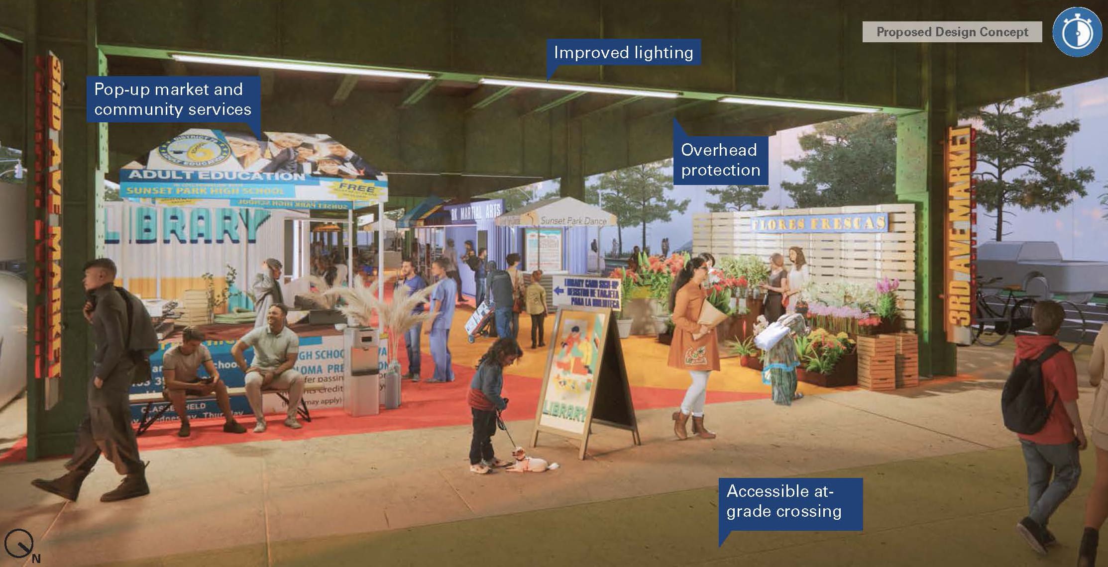
Renderings show the dark, dirty intersections under the elevated portions of the highway transformed into clean, well-lit community spaces with bike lanes, pedestrian walkways, and shopping kiosks.
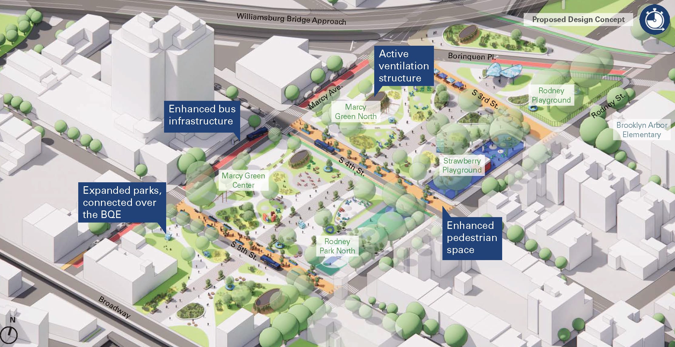
Most notable, though, are the agency’s proposals to cap sections of the BQE trenches in Williamsburg, Carroll Gardens, and Bay Ridge. Locals have for years discussed covering the trenches, effectively turning the BQE into a tunnel, and reclaiming the space above it.
“The bold concepts outlined in this report would invest in working-class neighborhoods and reconnect communities long divided by the Brooklyn Queens Expressway,” Rodriguez said in a statement. “Through a corridor-wide approach, we can equitably address safety, public space, and connectivity needs for neighborhoods that have often been left out of conversations around the BQE.”
What’s the timeline?
Still, Brooklyn is years and millions of dollars away from the renewed BQE depicted in the report, and only a few of the large-scale projects, like capping, are likely to come to fruition.

A $5.6 million federal grant the city won earlier this year will partially fund the planning process, said DOT Chief Strategy Officer Julie Bero, but isn’t enough to finish the designs — which will require extensive public input and study before they’re finalized.
DOT will probably be able to partially finish designing for at least two proposals – one each from BQE North and South, Bero said. They would need to apply for more funding to finish design and build out the chosen projects, and the city will need to work closely with the state to implement any projects on or over BQE North and South, since they’re owned by the state.
Which proposals will be chosen for more development will be decided on in partnership with the community, as DOT plans to launch a new public engagement drive next year.
However, there are a number of smaller projects already in the works around the BQE, and others that can move forward with the resources and funding already available to DOT.
It plans to open delivery “microhubs” under the BQE in Williamsburg and Clinton Hill in the near future to reduce truck traffic and emissions on local streets. On October 6, a new flea market — BQFlea, a partnership between Brooklyn Flea and DOT — will launch on Meeker Avenue, temporarily transforming the space into an open-air community market.
In the short term, without outside investment, the city can also install street safety improvements using paint, planters, seating, and lighting.
“Working with all levels of government, including our federal and city partners and surrounding communities, we are examining innovative ways to enhance the quality of life for residents along the corridor and look forward to our continued work with all partners and stakeholders to lay out the future of the BQE,” said New York State DOT Commissioner Marie Therese Dominguez, in a statement.
What would it look like to cap the BQE?
The report suggests capping the BQE in several places: Between Division Avenue and Borinquen Place in Williamsburg; along Hicks Street between DeGraw and Union streets and at Kane Street in Carroll Gardens; and at Leif Ericson Park and McKinley Park in Bay Ridge.
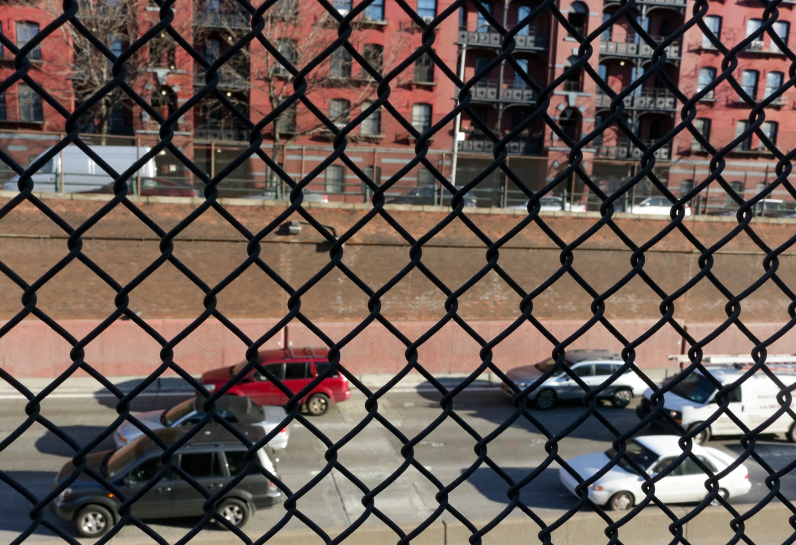
Caps would add or extend park space in those areas, connect disjointed neighborhoods, and tamp down noise and vehicle exhaust from the highway. Neighbors and local organizations have for years pushed to cover the BQE, citing health effects the highway has on surrounding neighborhoods.
Covering the BQE to develop park space would likely be very expensive. In past years, officials have speculated it could cost as much as $200 million just for a Williamsburg cap.
While Bero said the caps are “a very likely candidate” to be developed further with the federal funding, it will all come down to what the communities want.
What else is proposed?
DOT’s proposals are radically different in each section of the BQE, and are largely dependent on the community’s concerns. Almost all include pedestrian and cyclist enhancements, as areas below and along the BQE are more dangerous for all who use them.
Some envision utilities under the elevated portions of the BQE. In Williamsburg and Fort Greene, for example, the agency pitched adding more semipermanent markets, micro hubs, metered parking, and secure bike storage.
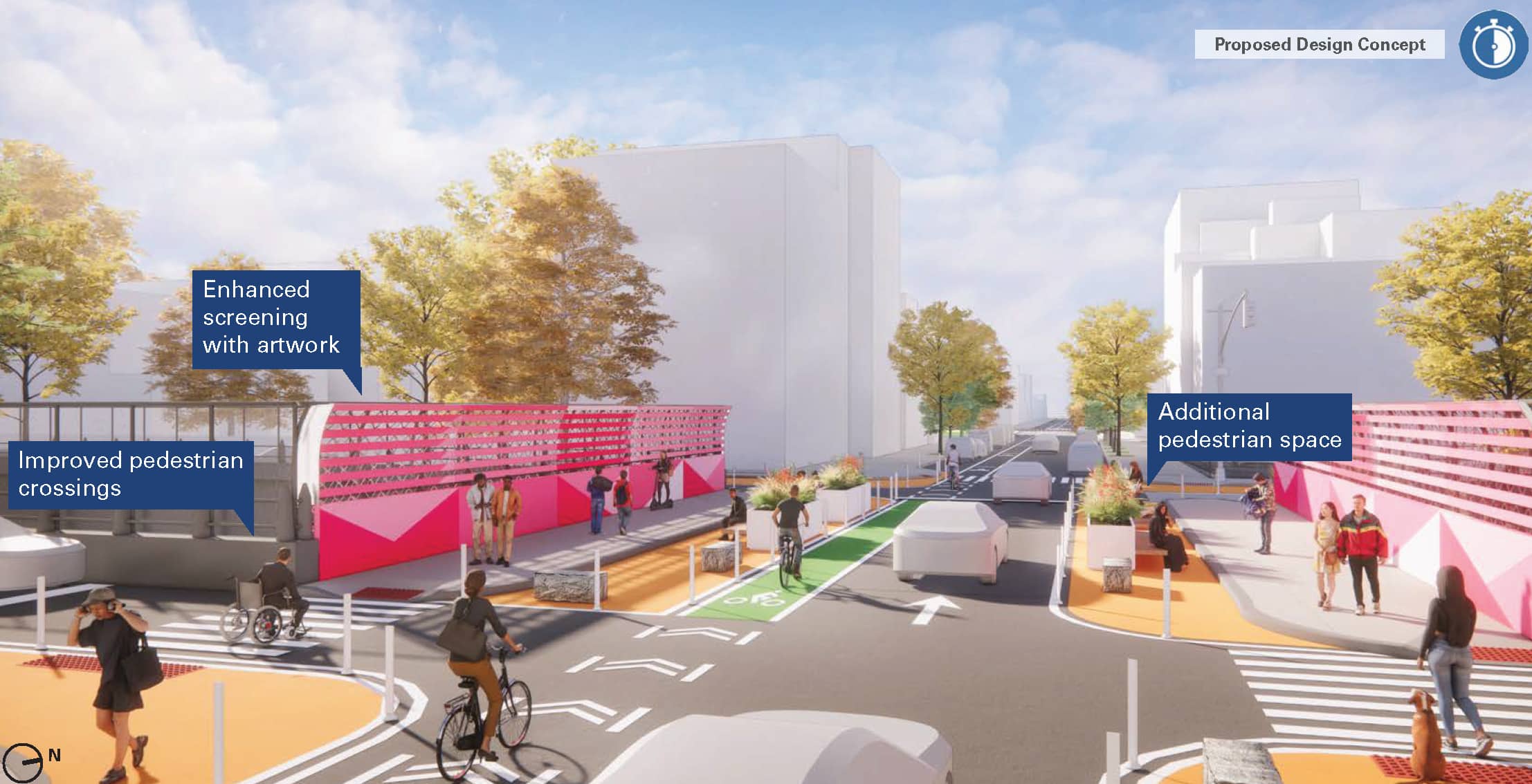
The median on Hamilton Avenue in Red Hook — currently a dark, unfriendly area — is reimagined in the report as a well-lit pedestrian space with walkways, greenery, and benches.
Since the larger-scale projects will take a lot of time, money, and cooperation from the state and federal government, the report also puts forward short and medium-term projects to help move along its goals in the interim. Painted crosswalk extensions, protected bike lanes, and public art installations would improve pedestrian experiences and safety while big projects are developed further.
What about the cantilever?
The 1.5-mile BQE Central, including the aging triple cantilever, is the only city-owned part of the BQE, and is set to be reconstructed as part of a separate plan — which requires separate federal funding.
What’s next?
In the short term, more planning and refinement is around the corner. DOT will continue to develop its ideas and review the proposals detailed in the new report with state officials and community members. Eventually, as Bero said, at least two projects will be chosen for further evaluation and possible construction. Some “near term” proposals could be constructed earlier, and a number of agency projects along the BQE corridor are already under way.
Additional reporting by Ben Brachfeld
Editor’s note: A version of this story originally ran in Brooklyn Paper. Click here to see the original story.
Related Stories
- Taking Up Locals’ Pleas, DOT Mulls Capping BQE to Connect Communities
- Sweeping Overhaul of Crumbling BQE Likely Delayed Until 2028
- Newly Formed Environmental Coalition Demands Community-Led BQE Overhaul
Email tips@brownstoner.com with further comments, questions or tips. Follow Brownstoner on X and Instagram, and like us on Facebook.



Decking over sounds great, using the underside for delivery hubs seems useful, but the idea that people are going to want to hang out and enjoy a space under a piece of polluting infrastructure sounds like putting lipstick on a pig. Bury the whole thing, or tear it down.